
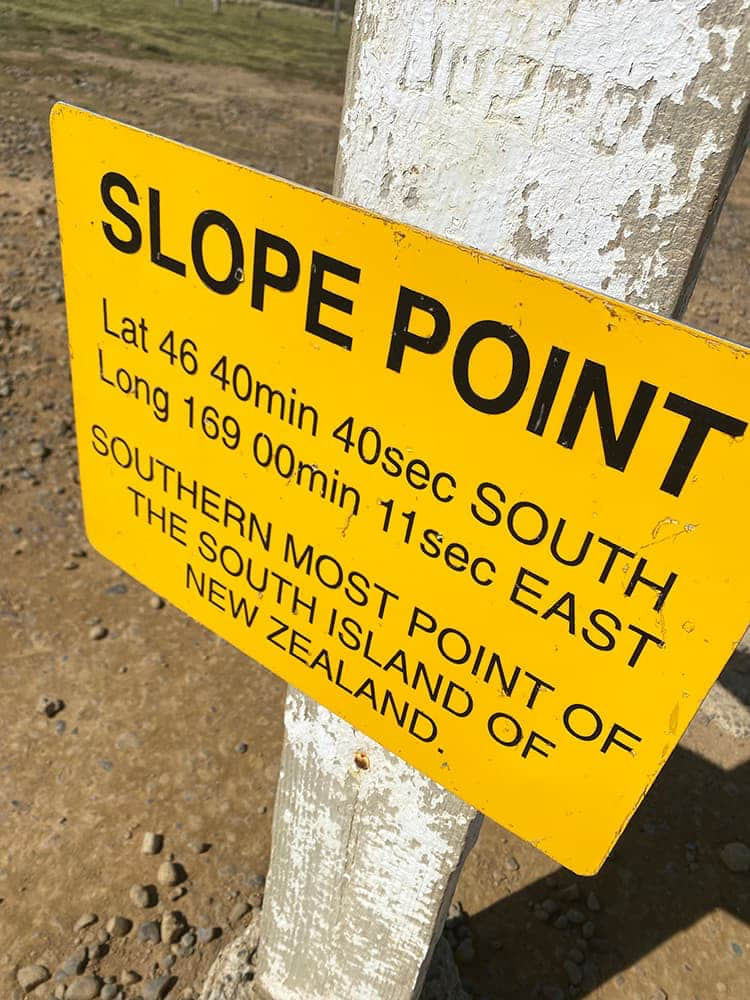
Slope Point - The South Island's most southern point in New Zealand
Standing there, it is hard to believe Antarctica’s South Pole is the next stop. There is nothing but the ocean between you and the next piece of land. I was struggling with the distances. Standing here, you start to understand that the planet is rather big. Slope Point is an excellent place for you to get some perspective.
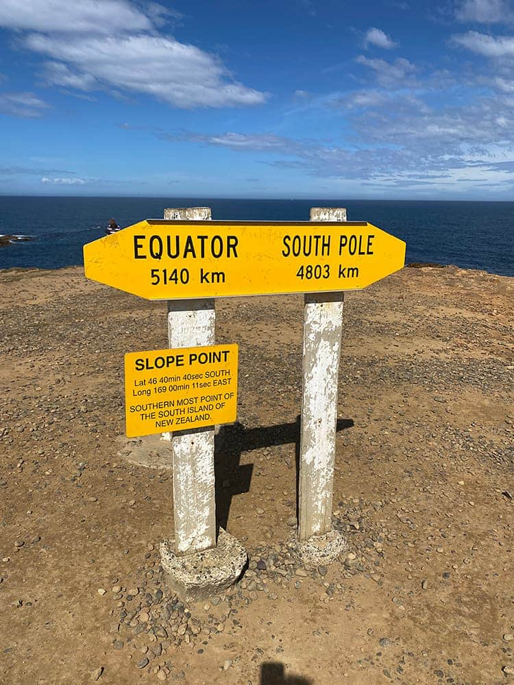
You will see a yellow AA sign when you get there. By the way, that’s pretty well all that is there – you could drive past Slope Point and think it is only a farmer’s field.
The AA signpost (see the pictures below) is there to show you the distances from Slope Point to the equator (5140km) and the South Pole (4803km); what surprised us was the distance to the South Pole – we never thought the South Pole was so far away from New Zealand. We felt closer to the South Pole than the equator – it turns out that we are right in the middle!
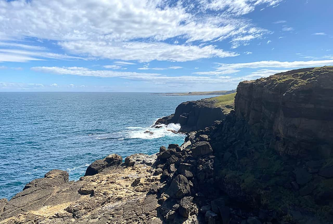
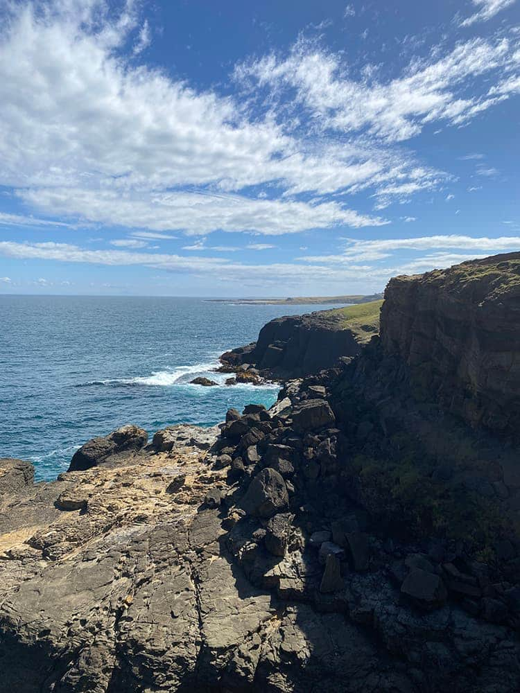
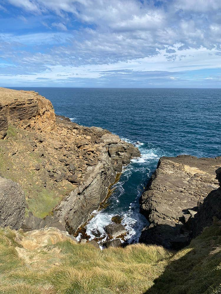
The prevailing winds, “The Roaring Forties”, have shaped the Southland coastline from vertical cliffs with etched horizontal wind lines to flat vegetation with very few trees. The trees you see are permanently on a forty-five-degree angle – a telltale sign that the wind has some force!
Slope Point is more of a geographical point of interest than an attraction
Worth a visit so you can say you have stood at the southernmost point of South Island/ New Zealand. A fantastic piece of trivia you can tell your Grandchildren or not.
It is a gentle 20-minute walk across private farmland to get there. Slope Point is located just 17km From Waipapa Point, and its over one-hundred-year-old lighthouse (built in 1884) is just 1.5 hours from Invercargill.
Another southern point is Stirling Point in Bluff, famous for its yellow international direction sign.